Walhalla
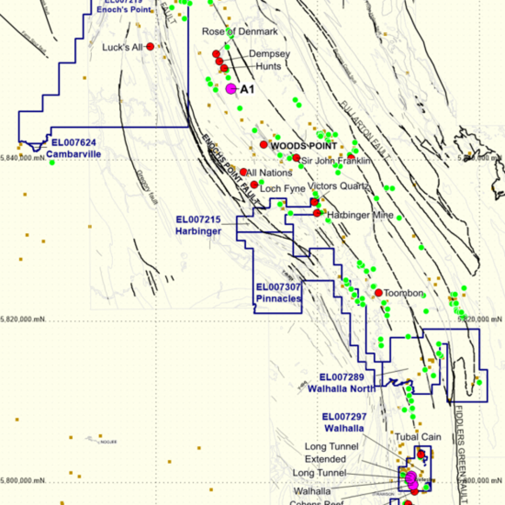
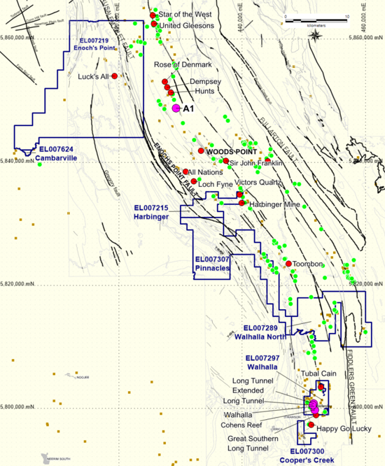
Our 100% owned Walhalla Project is located in Gippsland Victoria, around 180 kilometres east of Melbourne. It lies within the Melbourne Zone of the Lachlan Fold Belt and covers the Woods Point- Walhalla Belt, a geological feature which is contains a number of significant historical workings, including the historic Walhalla mining camp – home to Cohens Reef and Long Tunnel – some of Victoria’s largest historic gold deposits.
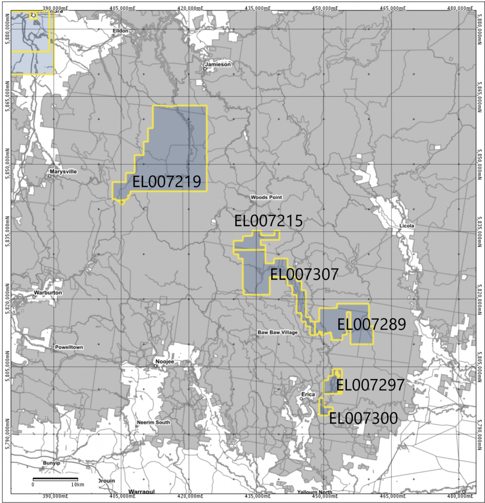
We currently hold six active Exploration Licences as part of this project:
- EL007297- Located in the central Walhalla area.
- EL007289 –North of Walhalla.
- EL007215- South of Woods Point – Harbinger.
- EL007300 – Coopers Creek.
- EL007307 north-west of Walhalla – the Pinnacles.
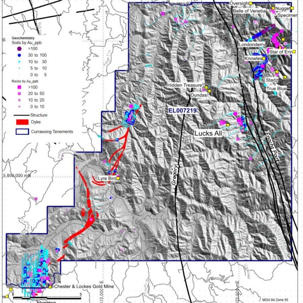
- EL007219 near Enoch’s Point
We conducted drilling in remote forest in the Enoch’s Point area in 2022 under a Low-Impact authorisation from ERR.
Currently, we are planning low-impact exploration drilling in EL007307 – the Pinnacles tenement.
Reconnaissance exploration will be conducted throughout the Walhalla group of tenements in 2023.
Total historic hard rock gold production from Walhalla
of 1,510,309 ounces at a recovered grade of 33.59 g/t Au.
Dozens of high priority exploration targets
including former mines most with no modern drilling or exploration.
Faulted dyke structures
have same age of mineralization as Fosterville and elsewhere in the Melbourne zone.
| Exploration Licence | Area km2 | Hardrock Prospects | Historical Producers | Recorded Au (oz) | Total Ore (t) | Au g/t | Total Drill holes in EL |
|---|---|---|---|---|---|---|---|
| Pinnacles | 103 | 5 | 3 | 4,537 | 8,539 | 16.26 | 0 |
| Walhalla North | 92 | 13 | 5 | 5,561 | 6,552 | 25.98 | 0 |
| Walhalla | 19 | 50 | 12 | 1,458,750 | 1,293,090 | 34.53 | 73 |
| Hardbinger | 34 | 7 | 4 | 19,692 | 19,870 | 30.34 | 1 |
| Enoch’s Point | 291 | 14 | 7 | 21,769 | 48,462 | 13.75 | 4 |
| Cooper’s Creek | 8 | 0 | 1 | Former copper & PGE mine | 52 for 3550m | ||
| Total | 547 | 89 | 32 | 1,510,309 | 1,376,513 | 33.59 | 130 |
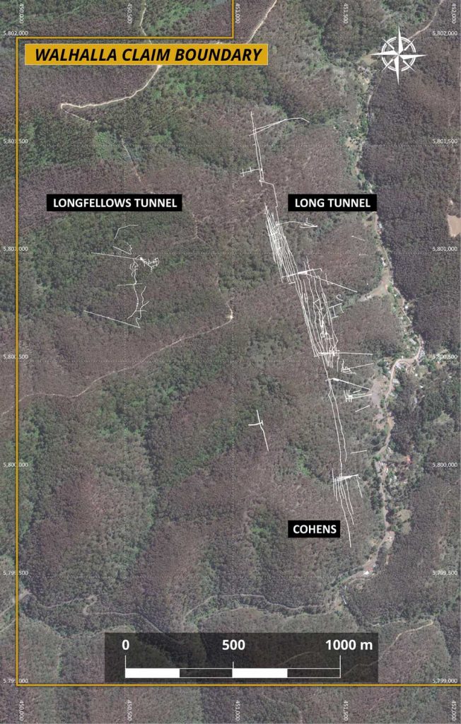
- The Walhalla license application includes Cohen’s Reef with a past production of 1,479,851 oz from 1,429,298 tonnes at an average grade of 32.2 g/t Au (GeoVic, 2020).
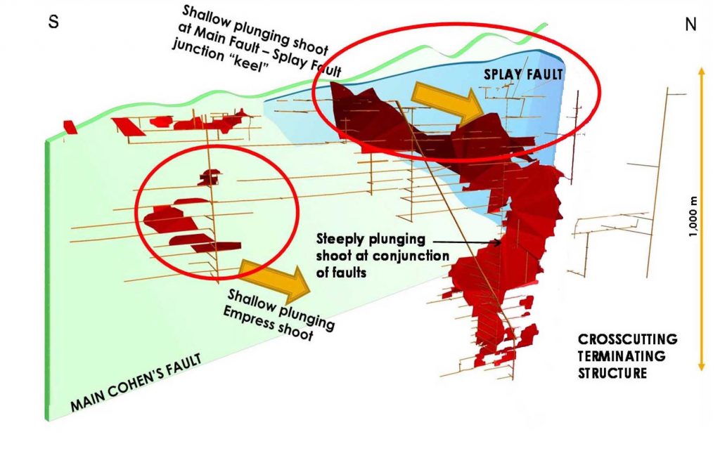
- The production at Cohen’s Reef came from a single mineralized shoot mined to 1120m depth.
- Mineralization was controlled by the steeply west dipping Cohen’s Shear zone, which was reactivated during gold mineralization in the Middle Devonian Tabberabberan orogeny. This is the same age mineralization as Fostervillle and elsewhere within the central Melbourne zone.
- The known extent of Cohen’s Reef is approximately 1500 metres long and 1134 metres deep, along the valley of the township of Walhalla.
- The extensive and continuous reef is predominantly a laminated quartz-carbonate vein with some associated stockwork veins, and in places incorporates sheared dyke and meta-sedimentary rocks.
- The reverse fault lies along the margin of an extensive but narrow dyke, within a complex fifty-metre-wide shear zone. Gold mineralization is mainly in laminated quartz veins in the reverse faults, associated with pyrite, arsenopyrite, galena and stibnite.
- Pyrite alteration envelopes extend to 10m into the host rocks, while more abundant arsenopyrite extend 2m.
- Historical production along Cohen’s Reef concentrated on visible gold within the laminated reef system.
- Recent assay results have highlighted the increased levels of visible gold, and the presence of disseminated gold, especially along dyke margins.
- The ten highest hold assay results (5-12 g/t) from recent drilling in proximity to Cohen’s Reef are found in laminated veins within or on the margins of dyke; or in laminated or brecciated veins within meta-sedimentary rock, predominantly shale (Goldstar, 2007).
- Historic mine plans indicate mineralization at Cohen’s Reef remains open at depth

